
2023 Monitoring Report on the German Strategy for Adaptation to Climate Change read more
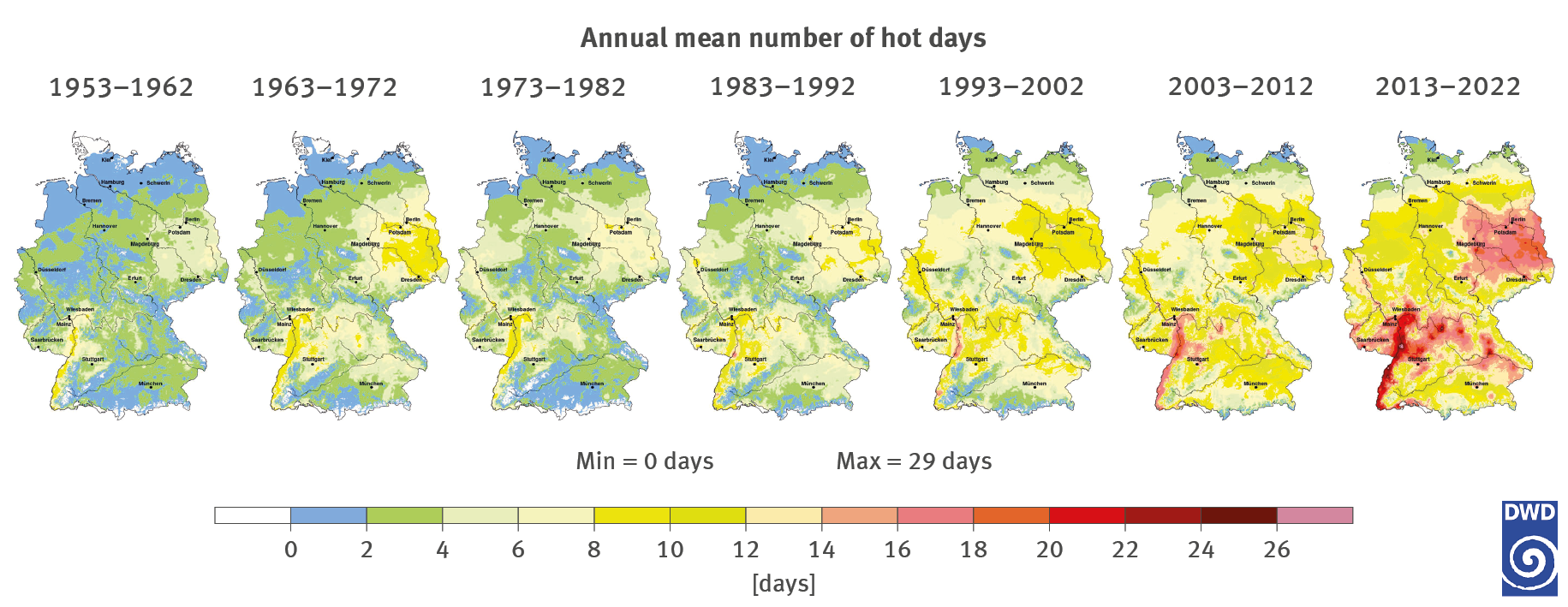
The chart consists of seven maps of Germany. The maps convey the mean annual number of hot days displayed in a very small unrecognisable grid for the following periods: 1953–1962, 1963–1972, 1973–1982, 1983–1992, 1993–2002, 2003–2012 and 2013–2022. The range extends from 0 days (in shades of blue) to a maximum of 29 days (in shades of red), with two days each forming a category. From left to right the maps are increasingly dominated by shades of red. In the period from 2013 to 2022, the red shades dominate with a high number of hot days, especially along the Upper Rhine Rift Valley, in eastern Germany and in parts of the Bayerische Wald (in Bavaria). For the northern border of Germany, this period shows only a small area near the coast as belonging to the lowest category of 1 to 2 days.
